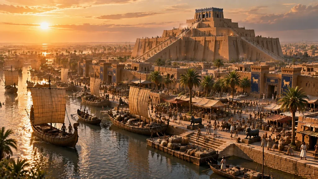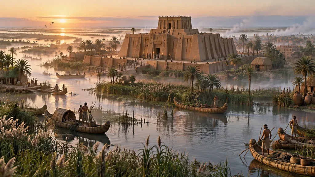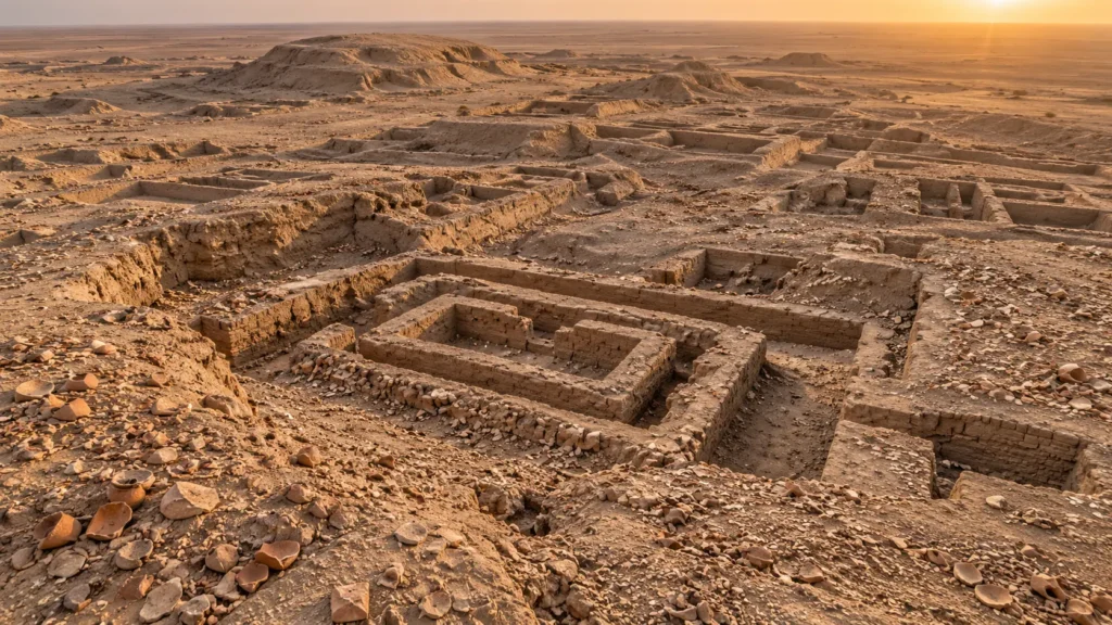
Long before the marble columns of Athens, the legions of Rome, or the Hanging Gardens of Babylon, there was Uruk. In the study of human history, the transition from scattered, egalitarian farming villages to complex, stratified urban societies did not happen everywhere at once. It happened first in southern Mesopotamia, and its absolute epicenter was Uruk.
Known as Unug to the ancient Sumerians, Erech in the biblical Book of Genesis, and located at the modern archaeological site of Warka in southern Iraq, Uruk was not merely a large settlement. It was the blueprint for the modern city.
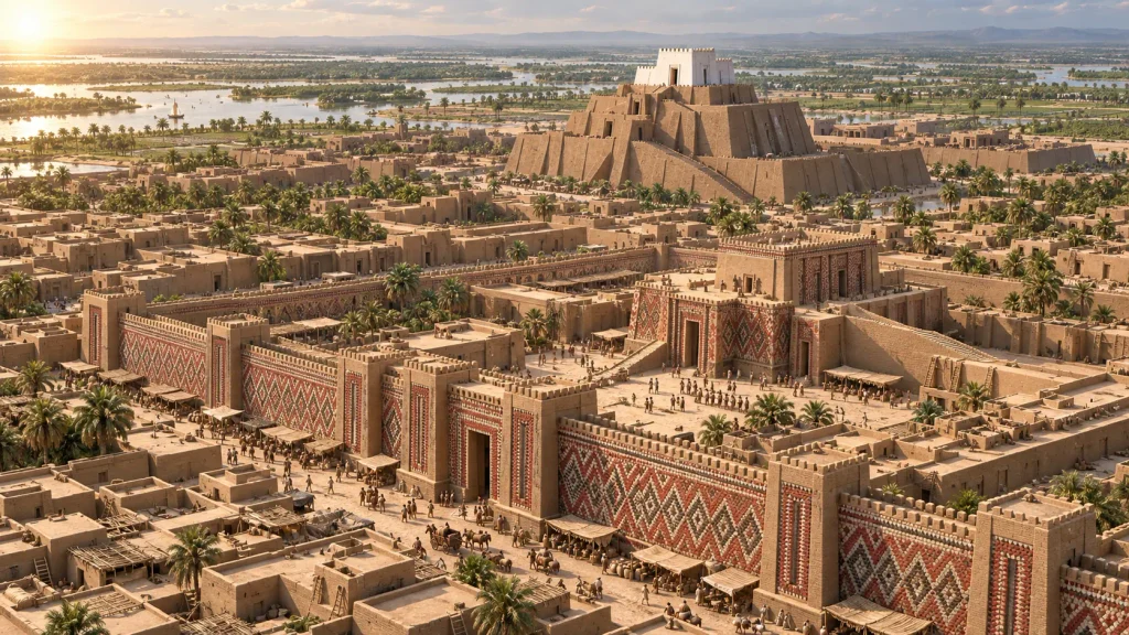
Reaching its zenith during the Late Uruk period (c. 3300–3100 BCE) and the Early Dynastic period (c. 2900 BCE), Uruk encompassed an astonishing 2.5 square kilometers (nearly 1 square mile) and housed an estimated population of 40,000 to 80,000 people. To put this in perspective, it was the largest urban center in the world at the time, surrounded by a massive nine-kilometer defensive wall allegedly built by its most famous king, the legendary Gilgamesh.
But Uruk’s historical dominance is defined by its intellectual and technological output rather than just its sheer size. The archaeological record proves that within the walls of this city, humanity achieved a series of revolutionary milestones:
- The Invention of Writing: The earliest known examples of proto-cuneiform script (dating to c. 3200 BCE) were excavated from Uruk’s temple precincts.
- Mass Production: The ubiquitous “bevel-rim bowls” found throughout the site offer the first physical evidence of standardized, mass-produced goods used for state-ration distribution.
- Monumental Architecture: Uruk pioneered the use of molded mudbrick and decorative clay cone mosaics to build massive ziggurats and temple complexes that dwarfed anything built before them.
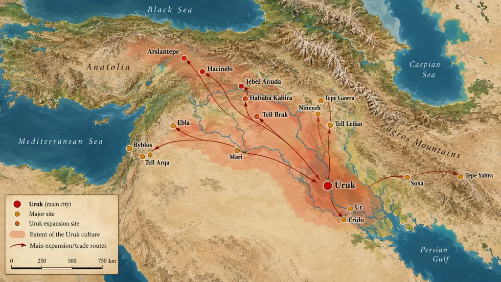
- The “Uruk Expansion”: Its cultural, administrative, and economic models were so successful that Uruk’s material culture spread across the ancient Near East, creating colonies and trade outposts as far away as modern-day Turkey, Syria, and Iran.
To understand Uruk is to understand the exact moment human beings decided to live in a civilization.
The Origins, Geography, and Stratigraphy of Uruk
The ruins of Uruk lie in the arid Muthanna Governorate of modern-day Iraq, roughly 30 kilometers east of the city of Samawah. However, the desolate, dusty landscape that greets modern archaeologists is a stark contrast to the rich ecosystem that birthed the city.
The Paleoclimate and the Euphrates River
During its foundation in the late Ubaid period (around 5000–4000 BCE), the geography of southern Mesopotamia was radically different. The waters of the Persian Gulf reached much further inland than they do today, creating a vast, fertile wetland ecosystem. More importantly, Uruk was positioned directly on the ancient main channel of the Euphrates River.
This geographical positioning was the engine of Uruk’s survival and dominance. The environment of the Mesopotamian alluvium lacked basic resources—there were no timber forests, no workable stone, and no metal ores. What it did have was an inexhaustible supply of mud, clay, and river water. By mastering hydraulic engineering, the early inhabitants dug complex canal networks to control the chaotic spring floods of the Euphrates. This irrigation system allowed for the cultivation of barley and wheat on a massive scale, generating the agricultural surplus necessary to feed a growing population of non-farmers: priests, administrators, artisans, and eventually, soldiers.
The Amalgamation of Kullaba and Eanna
Archaeological evidence—primarily driven by the extensive excavations of the German Oriental Society (Deutsche Orient-Gesellschaft) beginning in 1912—reveals that Uruk did not start as a single, unified city. It formed from the gradual merging of two distinct, older settlements located on opposite banks of the ancient river channel:
- Kullaba: The older western settlement, dedicated to the sky god Anu.
- Eanna: The eastern settlement, dedicated to the goddess of love, war, and fertility, Inanna (later known as Ishtar).
As the population grew, the space between these two settlements filled in, creating a single, sprawling urban matrix. The districts of Kullaba and Eanna would remain the two monumental religious and administrative hearts of the city for millennia.
Digging Through Time: The Deep Sounding
To understand the sheer age of Uruk, archaeologists rely on stratigraphy. In the Eanna precinct, excavators dug a “deep sounding”—a vertical trench cutting through layers of human occupation down to virgin soil. They uncovered 18 distinct layers of history.
Levels XVIII through XIV correspond to the Ubaid period, showing simple village life. But as the layers rise into the Uruk period (Levels XIV to IV), the archaeological record explodes with innovation. By Level IV (c. 3200 BCE), archaeologists uncovered the earliest clay tablets bearing pictographic writing, cylinder seals used for accounting, and the massive limestone foundations of the Eanna temples. This stratigraphy proves that Uruk’s rise to power was not an overnight conquest, but a slow, continuous mastery of its environment over thousands of years.
The Rise to Power: Bureaucracy and the Uruk Expansion
Uruk did not become the capital of the ancient world through military conquest alone. Its true power lay in an unprecedented level of administration and economic centralization. During the Late Uruk period (c. 3400–3100 BCE), the city’s ruling class—led by a figure known as the En (a priest-king)—realized that managing a population of tens of thousands required more than just memory and verbal agreements. It required a system.
The Invention of Proto-Cuneiform
The most profound technological leap in human history occurred in the Eanna temple precinct: the invention of writing. Excavations at Eanna Level IV revealed thousands of clay tablets inscribed with what archaeologists call “proto-cuneiform.”
Unlike later literature, these earliest texts were not poems, prayers, or historical chronicles. They were purely administrative. The priests of Uruk needed to track sheep, record grain yields, and calculate beer rations for workers. By pressing a reed stylus into wet clay, they created pictographs and numerical systems to manage the city’s vast redistributive economy. Writing was born not out of a desire for artistic expression, but out of absolute bureaucratic necessity. Uruk effectively invented the spreadsheet.
The Bevel-Rim Bowl: The World’s First Mass Production
If writing was Uruk’s greatest intellectual invention, the bevel-rim bowl was its most telling physical artifact. Found by the tens of thousands in Uruk’s archaeological layers, these crude, undecorated clay bowls are the earliest known examples of mass production.
Assyriologists believe these bowls were manufactured in standardized sizes to distribute daily rations of barley or beer to state workers. The presence of these bowls tells us something incredible about Uruk: it was a highly centralized welfare state. The temples controlled the agricultural surplus and paid their labor force in standardized rations. The bevel-rim bowl was, essentially, the disposable paper cup of the ancient world, proving that Uruk had mastered the logistics of feeding a massive urban workforce.
The Uruk Expansion
Armed with an invincible administrative machine and vast agricultural wealth, Uruk’s influence spilled out of the Mesopotamian alluvium. Archaeologists call this the “Uruk Expansion.” The city established trading colonies and enclaves hundreds of miles away in modern-day Syria (such as the site of Habuba Kabira), Turkey, and Iran. These outposts were built with exact Uruk-style architecture and used Uruk’s accounting tools (cylinder seals and clay bullae), ensuring a steady flow of timber, copper, and precious stones back to the metropolis.
The Early Dynastic Period: The Rise of the Lugal and the Great Wall
As Uruk transitioned into the Early Dynastic Period (c. 2900–2350 BCE), its administrative and political structure evolved. The secular, military power of the king (the Lugal, meaning “big man”) began to rival the religious authority of the temple priests.
The greatest physical evidence of this shift is the construction of the Great Wall of Uruk. According to later Sumerian traditions (including references to the historical king Gilgamesh), Uruk was fortified with a monumental defensive perimeter stretching for an astonishing 9 kilometers (5.6 miles) and reinforced with some 900 semi-circular towers.
Excavations by German archaeological teams confirmed the existence of this massive fortification. It was built using a technique distinctive to the Early Dynastic period known as “plano-convex” mudbricks (bricks that are flat on the bottom and curved on top). The construction of this wall represented a shift in the ancient world: Uruk’s unimaginable wealth now needed physical protection from rival, emerging Sumerian city-states like Ur, Kish, and Lagash.
The Religious Heart of Uruk: Eanna and Kullaba
Religion in Uruk was not just a matter of faith; it was the core of the economy and the state. As the city grew from the merging of two older settlements, it maintained two distinct monumental temple districts, each dedicated to a major deity of the Sumerian pantheon.
Kullaba and the Anu Ziggurat
The western district, Kullaba, was dedicated to Anu, the sky god and the original supreme deity of the Sumerian pantheon. Here, the architects of Uruk built the Anu Ziggurat, a massive stepped platform that predates the famous ziggurats of later eras.
Sitting atop this platform was the White Temple (c. 3200 BCE). Named for its striking white gypsum plaster, this temple was designed to be seen from miles away across the flat Mesopotamian plain. Its elevated position reflected the belief that temples were literal “waiting rooms” where the priests could commune with the gods descending from the heavens.
The Eanna Precinct: Domain of Inanna
The eastern district, Eanna (meaning “House of Heaven”), was dedicated to Inanna (later known as the Babylonian Ishtar), the goddess of love, fertility, and war.
The Eanna precinct was the true beating administrative heart of Uruk. It was here that the earliest proto-cuneiform tablets were discovered. The architecture in Eanna was unprecedented, featuring massive limestone foundations and the famous Stone-Cone Temple. The builders pressed thousands of baked clay cones—painted in black, red, and white—into the mudbrick walls to create intricate, geometric mosaics that protected the walls from weathering while displaying the wealth of the goddess.
Key Archaeological Discoveries at Warka
When the Deutsche Orient-Gesellschaft began excavating the ruins of Warka, they uncovered artifacts that fundamentally changed our understanding of ancient art. Beyond the administrative tablets, Uruk produced some of the earliest examples of complex, narrative artwork.
(Nota para Fernando: En el siguiente párrafo, puedes enlazar “Iraq Museum in Baghdad” a tu reciente artículo sobre los mejores museos).
Many of the most spectacular finds from Uruk are now housed in the Iraq Museum in Baghdad, serving as irreplaceable testaments to the city’s artistic mastery:
- The Warka Vase: Carved from alabaster around 3000 BCE, this stands as one of the oldest known works of narrative relief sculpture. The vase is divided into registers (horizontal bands). The bottom shows water and crops, the middle shows animals and naked workers carrying tribute, and the top register depicts the ruler presenting offerings to the goddess Inanna. It is a perfect, visual representation of Uruk’s hierarchical society.
- The Mask of Warka (The Lady of Uruk): Dating to 3100 BCE, this is a stunningly realistic life-sized marble face of a woman, likely a depiction of Inanna. Originally, the eyes would have been inlaid with lapis lazuli and shell, and a wig of gold leaf would have been attached to the head. It is one of the earliest accurate depictions of the human face in art history.
The Fall and Abandonment of Uruk
Given its status as the first great metropolis, it is tempting to imagine Uruk falling in a fiery, apocalyptic battle. The reality, however, is a much slower and more fascinating story of environmental change.
Uruk did not collapse at the end of the Early Dynastic period. Because of its immense religious prestige, the city survived for thousands of years. It was absorbed into the Akkadian Empire, heavily rebuilt by the kings of the Ur III dynasty, and remained an important center during the Babylonian and Assyrian eras. Astonishingly, Uruk even experienced a massive architectural revival during the Hellenistic (Seleucid) period in the 3rd century BCE, when a colossal new temple complex known as the Bit Resh was constructed for the sky god Anu.
The Shifting of the Euphrates
Uruk’s ultimate enemy was not a foreign army, but geography. The city’s entire existence depended on the main channel of the Euphrates River. Over the millennia, the heavy silt carried by the river slowly raised its bed, causing the Euphrates to naturally shift its course westward.
As the river moved further away from the city walls, the intricate network of irrigation canals that sustained Uruk’s agriculture began to dry up. Without water to grow grain or facilitate trade, the city could not sustain its massive population.
A Slow Death in the Desert
By the time of the Parthian and Sasanian empires (c. 250 BCE – 651 CE), Uruk had shrunk to a fraction of its former glory. As the waters receded permanently, the remaining population migrated to new settlements closer to the shifting riverbanks. By the time of the Islamic conquest of Mesopotamia in the 7th century CE, the once-mighty metropolis was almost completely abandoned.
The mudbrick temples and walls crumbled, slowly melting back into the earth to form the massive mounds, or tells, known today as Warka. The city that invented writing, mass production, and monumental architecture was swallowed by the desert sands, waiting over a thousand years for archaeologists to uncover its secrets.
Frequently Asked Questions (FAQ)
Is Uruk a country?
No, Uruk was an ancient Sumerian city-state located in southern Mesopotamia (modern-day Iraq). It was never a country, though its cultural and economic influence spread so widely across the ancient Near East that archaeologists refer to this period as the “Uruk Expansion.”
Are Uruk and Ur the same?
No, Uruk and Ur were two distinct, powerful city-states in ancient Sumer. While both were located in southern Mesopotamia and shared similar cultures, they were often political rivals. Uruk is famous as the first metropolis, while Ur is famous for its Great Ziggurat and the Royal Tombs.
Did Uruk become Babylon?
No, Uruk did not become Babylon; they were completely separate cities located miles apart. Uruk was the dominant metropolis of the ancient world during the 4th millennium BCE, whereas Babylon did not rise to major political prominence until much later, around the 18th century BCE under King Hammurabi.
Did Uruk have a ziggurat?
Yes, Uruk featured massive monumental architecture. The most famous example is the Anu Ziggurat, a colossal stepped mudbrick platform built around 3200 BCE in the Kullaba district. It was topped by the White Temple, dedicated to the Sumerian sky god, Anu.
What can you conclude about the people of Uruk?
The archaeological evidence from Uruk reveals a highly organized, innovative, and bureaucratic society. By inventing proto-cuneiform writing and using mass-produced items like bevel-rim bowls for ration distribution, the people of Uruk demonstrated a mastery of logistics, surplus management, and centralized government.
Does Uruk still exist and can you visit it?
The living city of Uruk no longer exists, having been abandoned by the 7th century CE due to the shifting of the Euphrates River. Today, it exists as the archaeological site of Warka in southern Iraq. While visiting is technically possible, it is extremely challenging for typical tourists due to limited infrastructure and travel advisories.
Further Reading and External Resources
To explore the archaeological data and historical context of Uruk in even greater detail, we recommend consulting the following institutional resources:
- The Metropolitan Museum of Art (Heilbrunn Timeline of Art History): An excellent, peer-reviewed essay detailing the material culture, proto-cuneiform development, and the phenomenon of the Uruk Expansion during the fourth millennium BCE. Read the essay: Uruk: The First City
- UNESCO World Heritage Centre: Official documentation on the Ahwar of Southern Iraq. This is the protected archaeological and ecological landscape that includes the ruins of Uruk (Warka), Ur, and Tell Eridu. Explore the site profile: The Ahwar of Southern Iraq
- World History Encyclopedia: A highly detailed, timeline-based overview of Uruk’s mythological kings, architectural achievements, and its long-term historical development. Read the encyclopedia entry: Uruk